London, Waterloo & South Bank
Year
1989-2005
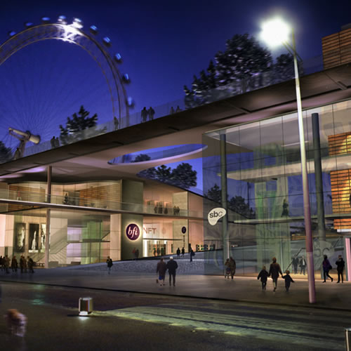
Showing a reanimated ground level and a direct route to the London Eye via Jubilee Gardens.
London’s South Bank hosts some of the world’s premier cultural facilities and has long been frequented by many kinds of people: local residents, workers, tourists and commuters, as well as music, theatre and museum goers. Despite all these elements, however, it had never achieved the urban buzz expected of it. We were hired by the South Bank Centre management to help diagnose and treat the problem.
We were able to trace the problem primarily to the area’s circulation system. Our evidence showed that the spatial layout of the area directed different groups of people onto different routes. This left many spaces empty for much of the time because several groups of people were present only at certain times of day. Underused spaces were colonised by anti-social individuals or groups who detered further use. The result was a spiral of decline in which there were relatively few locations where commercial, retail or catering outlets were viable.
Our recommendations largely focused on integrating the various user groups by providing new direct routes between Waterloo International Station, the Hungerford Bridge and the Riverwalk. We also sited new attractors in integrated locations, to take advantage of passing flows and added two new significant public spaces to act as attractors and orientation points.
Our recommendations have reversed the downward spiral. Many of the spaces in the South Bank Centre now feature a mix of different user groups as well as successful new catering and retail establishments.

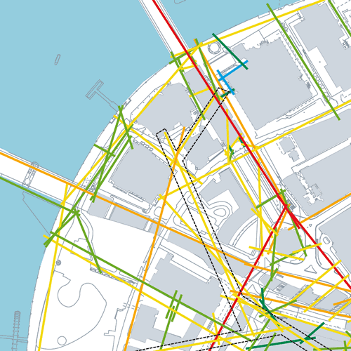
Highlighting the fragmented spatial layout of the South Bank Centre and the resulting low levels of spatial accessibility (green & blue).
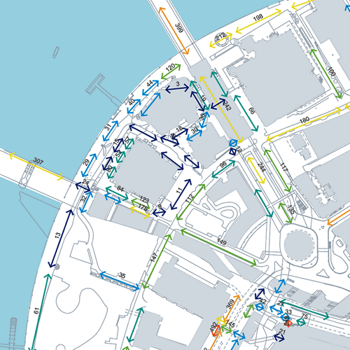
By simplifying the pedestrian route structure into a smaller number of more direct routes, spatial accessibility levels are significantly raised.
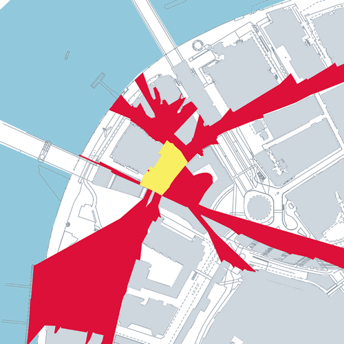
Highlighting low levels of pedestrian access to and through the South Bank Centre.
Showing the potential to create a new public space at the landside entrance to the Royal Festival Hall.
