Derry~Londonderry, Urban Strategy
Year
2010

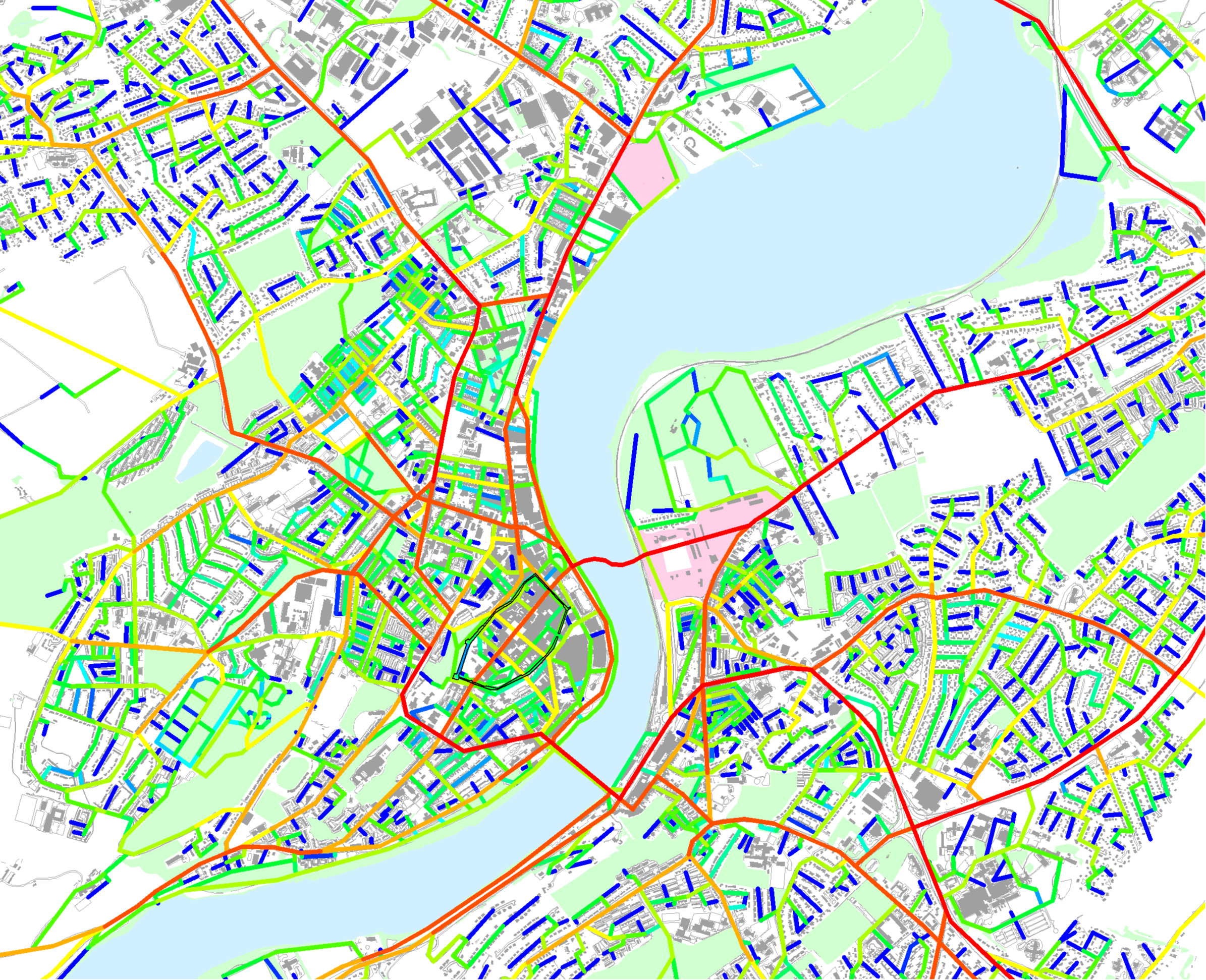
Topography analysis highlighting the Walled City as an island and the industrial corridor as a valley
The city of Derry~Londonderry in Northern Ireland is undergoing rapid growth with a number of large masterplan developments in the pipeline. The main challenges for any future development in the city were to overcome the history of social division, the constraints of a complex transport and urban infrastructure and the topography.
Ilex Urban Regeneration Company recognised the need for a holistic approach to ensure new developments would be embedded into their local contexts. They commissioned Space Syntax to provide an Urban Baseline Study and to evaluate the impact of proposed masterplans on how the city functions and can grow.
Using spatial modelling techniques and on-site surveys, the spatial potential of the whole city was assessed with a particular focus on two masterplan sites, Fort George and Ebrington. The following questions guided the study:
will the overall regeneration spatial strategy overcome the current fragmentation of the area?
do the proposed developments take advantage of their location?
will the proposed developments contribute to the integration of the most deprived areas in the city?
what are impacts of each masterplan and cumulative impacts of all masterplans on a wider area including the Peace Bridge?
The Urban Baseline Study including spatial accessibility analysis and pedestrian movement analysis identified opportunities and constraints in the city. It highlighted the fragmentation of spatial structure of the city due to the natural topography. The city appeared not to be exploiting attractions such as the River Foyle and the Walled City.
Our assessment of the proposed masterplans, in combination with our understanding of the potential that the city offered, led to a series of design recommendations.
All findings and conclusions were communicated with the design team and the Ilex board. The masterplanning projects are still ongoing.

Local spatial accessibility model of the existing revealing that highly accessible route networks are concentrated in the city side while the riverfront is isolated from such street networks
The analysis reveals good potential of the new bridge as part of the major structure of the city connecting both sides of the river
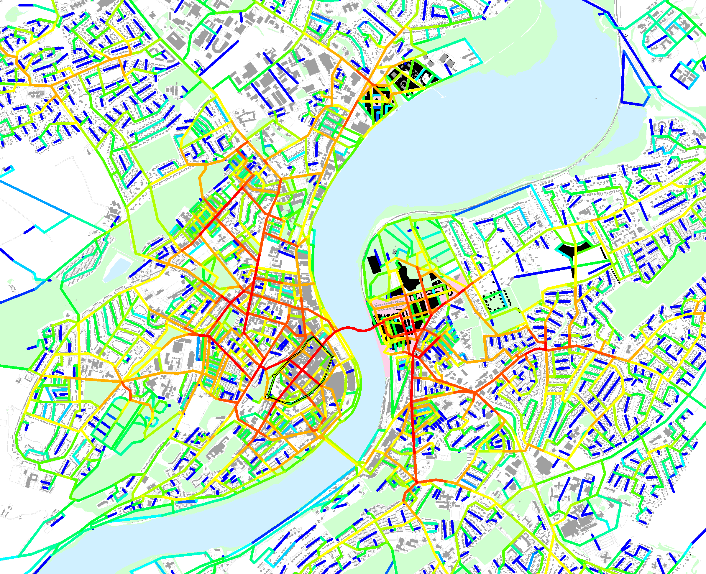
The analysis demonstrates cumulative impacts of the proposed masterplans on the route hierarchy of the city
